Highly Trusted Land Surveyors Since 1994
30 Years Serving Kilifi County & Coastal Kenya
Professional Excellence
Licensed ISK surveyors delivering precision mapping and cadastral services across Kenya, meeting international standards and local requirements.
Protect Your Land Investment with Licensed ISK Surveyors
Licensed ISK surveyors with 30 years serving Malindi and coastal Kenya. From cadastral surveys to drone mapping and GIS systems, we deliver precision, compliance, and proven reliability you can trust.
Our Services
Comprehensive land surveying solutions backed by 30+ years of coastal Kenya expertise
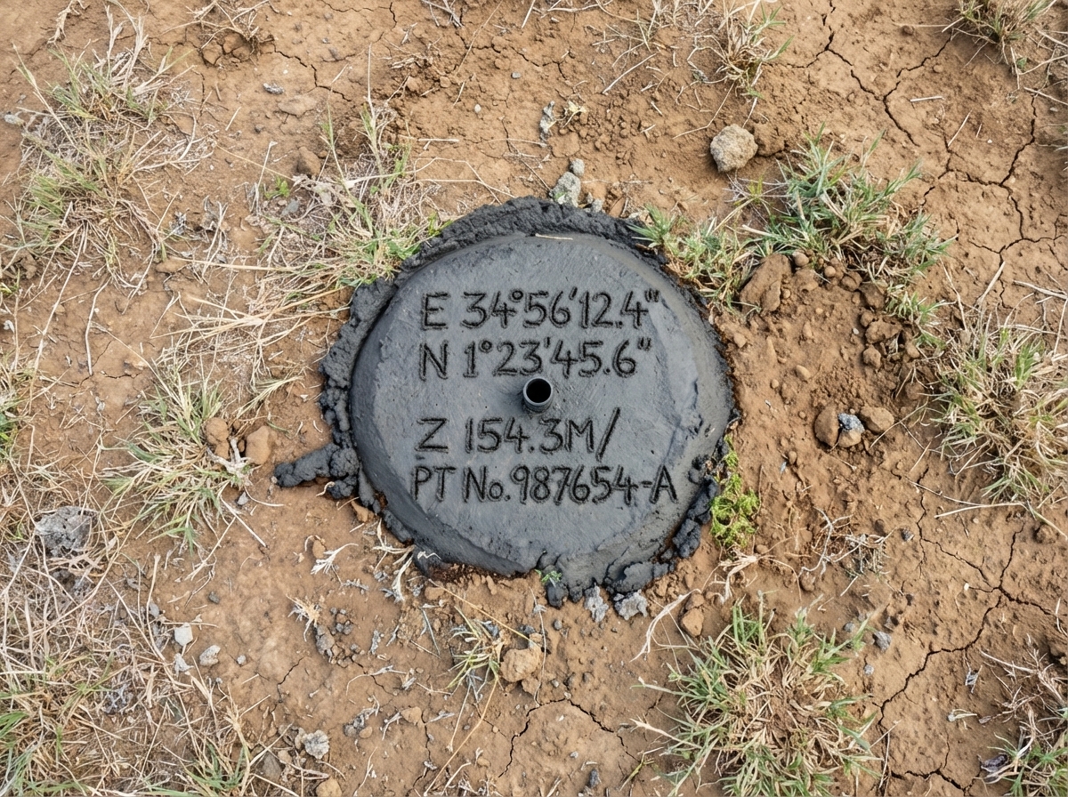
Cadastral Surveys
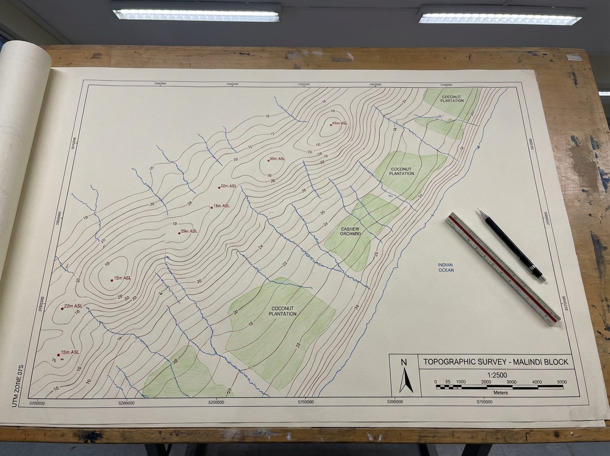
Topographic Surveys

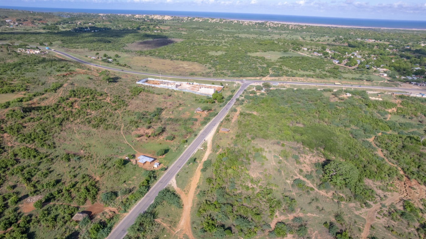
Drone & Aerial Surveys
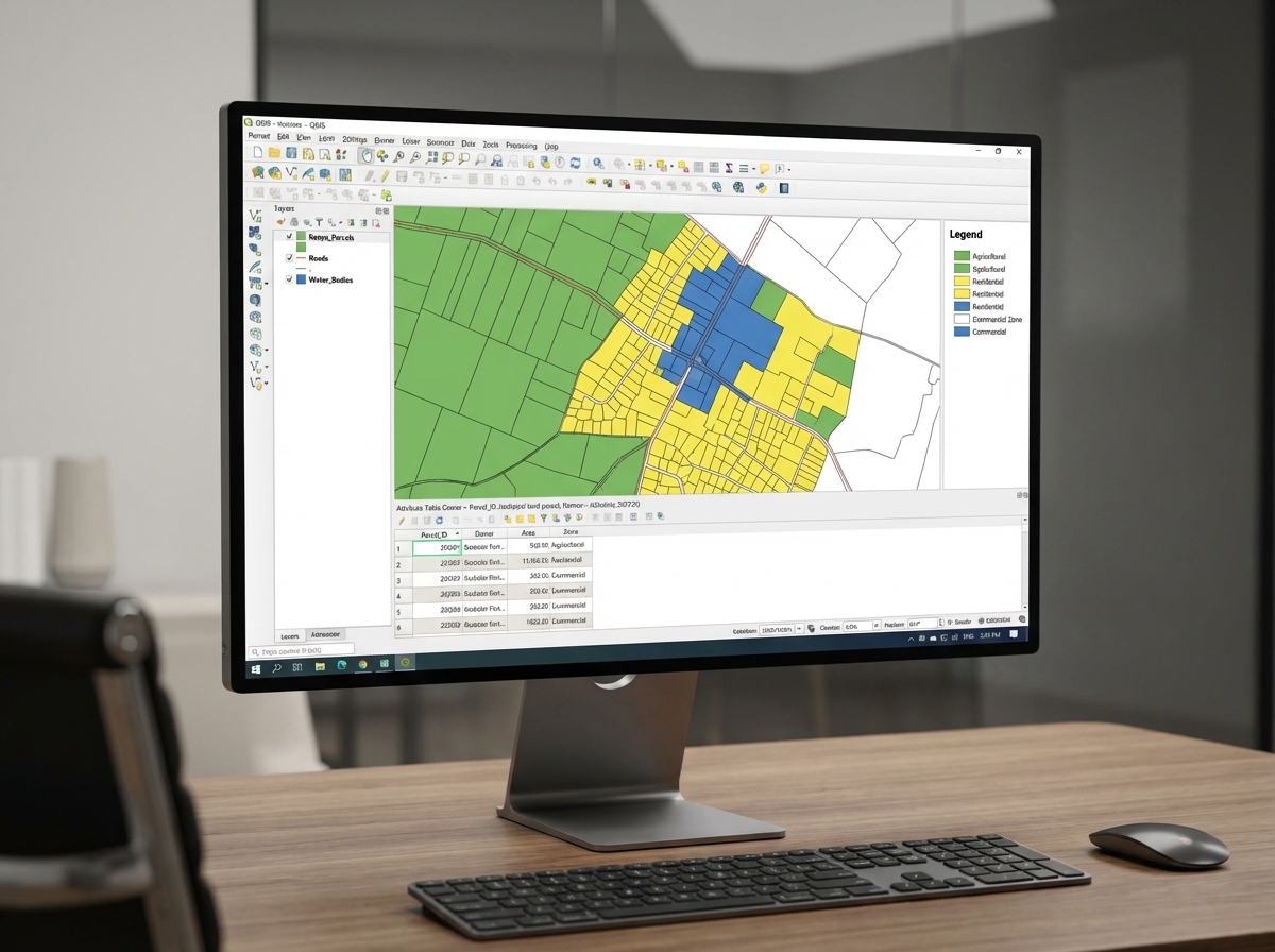
GIS & Spatial Data Infrastructure
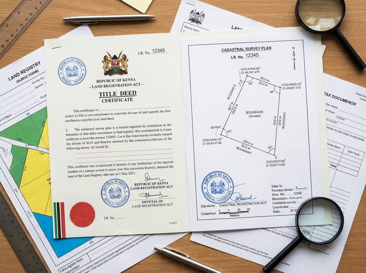
Boundary Verification & Due Diligence
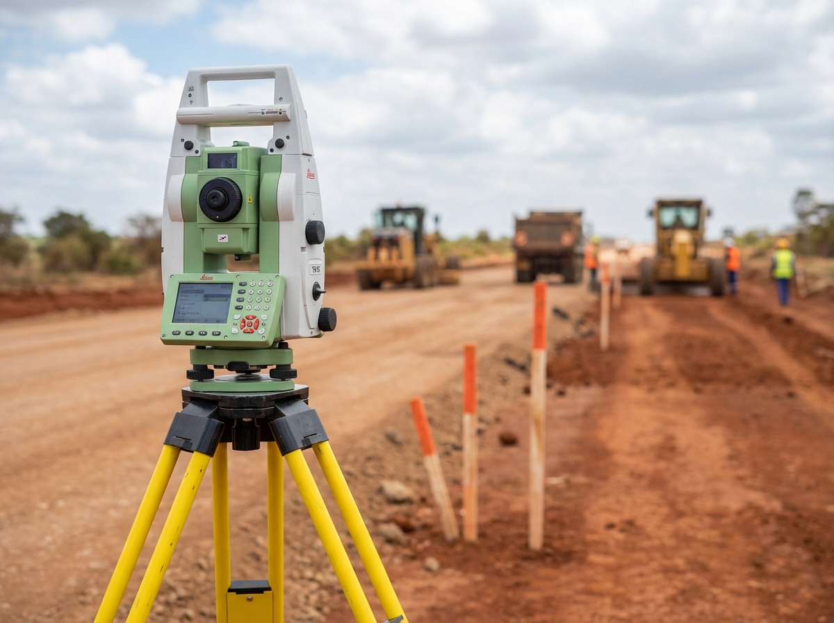

Precision Technology
State-of-the-art equipment delivering accurate results on every project.
From CORS-enabled RTK GNSS systems to advanced drone mapping with centimeter-level accuracy, Walterland combines cutting-edge technology with decades of surveying expertise to deliver precise, reliable land measurement solutions that meet government standards.
Why Choose Walterland
Trusted expertise delivering precision land surveying solutions across Kenya since 1994.
30 Years Established
Since 1994, serving Kilifi County, coastal Kenya, and nationwide. A proven track record of client satisfaction and no major legal disputes
Fully Certified & Licensed
ISK-registered surveyors, NCA Category 6 & 7 certified, KCAA drone licensed, AGPO women-owned (30% government procurement preference)
Modern Technology
DJI RTK drones, CORS-enabled GNSS, precision total stations, and enterprise GIS software. All delivering centimeter-level accuracy
3 Strategic Office Locations
Malindi HQ (since 1994), Watamu, and Kisumu. Coastal expertise with national reach
Government Trusted
9+ completed KeRRA & county projects, long-term Kilifi County GIS partnership, consistently high approval rates with government agencies
Integrated Services
Survey, Construction, and GIS under one roof. NCA Cat 6 and 7 certified for infrastructure projects
Ready to Get Started
Ready to Protect Your Land Investment?
Get a professional survey from highly trusted land surveyors. Licensed, certified, and serving you for 30 years with proven client satisfaction.
Professional land surveying services delivered with precision and integrity. Licensed ISK surveyors, NCA certified, AGPO women-owned. Contact us today for a consultation.